GDAL
GDAL - (Geospatial Data Abstraction Library) is a library for reading and writing raster geospatial data formats, released under the Open Source X/MIT license by the Open Source Geospatial Foundation (OSGeo). The library provides calling applications with a single abstract data model for all supported formats. Additional utilities can also be included at build time. With these utilities, data conversion and processing can be done using the command line interface.

Introduction
Automatic installation of Python and GDAL for Windows
Are you new to Python for geospatial processing? Do you find the installation process a bit cumbersome? Then you've come to the right place! I hope that for the experts in the field, this will save you some manual work if you're using Windows 10.
Installation
Ok! Let's get started!
Go to the GitHub repository and download the Python_GDAL_ (32/64) .bat file or download the files directly. Make sure you save it as a command file (* .bat).
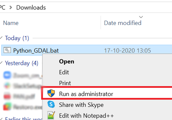
Right-click the downloaded file and select Run as administrator.


Finish
Run the downloaded file with administrator privileges
The script will download the installation files and run them one by one, make sure you are connected to the Internet. If your connection is too slow or the download server happens to be down, the script will terminate. In that case, you can simply run it again.
After downloading the files, the Python installation window will automatically appear, after which you will need to select Configure Installation
Comments
How do I do this? QGIS 2.16.2 I have. It seems that in the links above, this option to install GDAL is not mentioned, I can not navigate.

Brandon
So GDAL is already in the program files in QGIS. The utilities are all in the bin.
Another thing is that the re-installation may have overwritten its settings.
It is better to remove everything (and QGIS) and install again. QGIS 64-bit is also available.

Wayne


